Collapsed Surge Tunnel Investigation
Client:
Not for disclosure
Overview:
The client had a major collapse at a fault crossing a 1940’s head race tunnel. This tunnel supplied water to a hydro-electric power station and the collapse restricted the flow of water and power generation capacity. Rocks, clay material and wooden square sets had flowed down stream for over 100m from the failure.
Location:
Eastern Australia
Challenge:
Understanding the depth and height of the failure was important for designing the by-pass development and understanding the failure mechanism for potential interaction with the surface. Access to the failure area was only available via a surge shaft into the tunnel as directly above the failure area is a National Park.
Service/Approach:
MINELiDAR completed a hand-held scan of the existing 1940’s development up to the failure. We then customised a skid with a pole to be able to safely get the unit inside of the failure void.
Solution/Result:
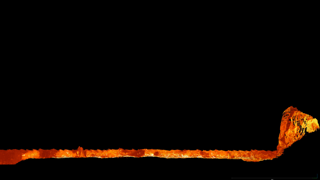
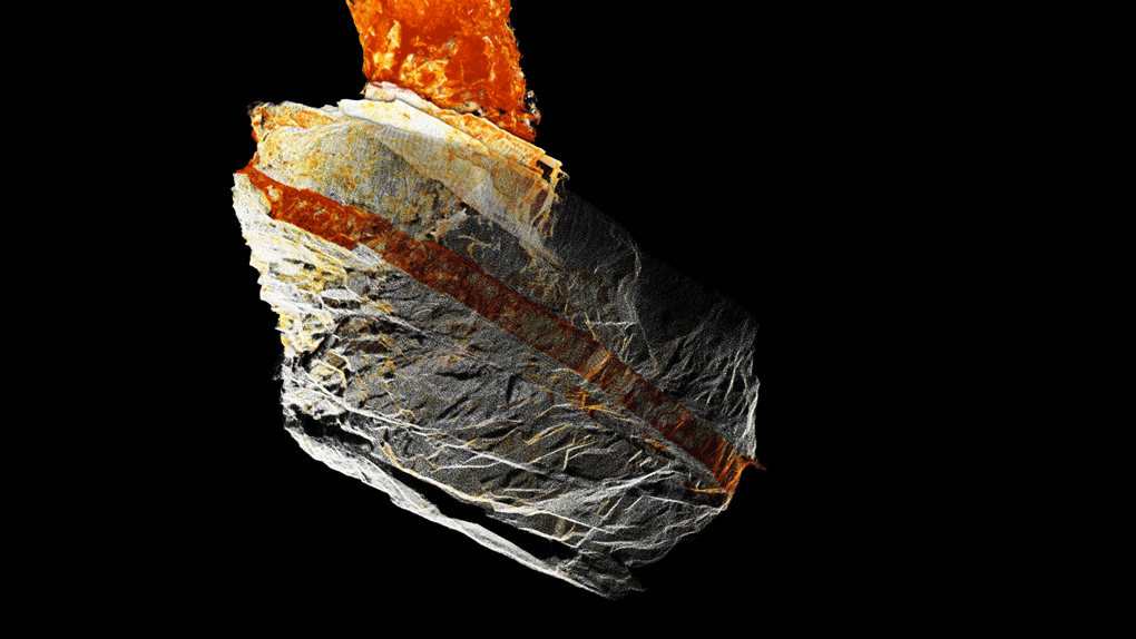
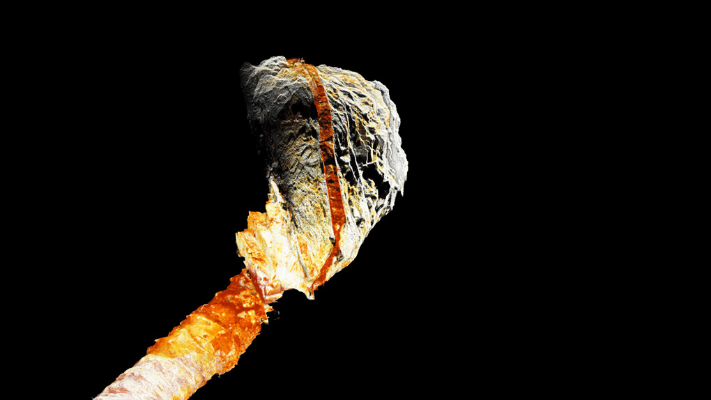
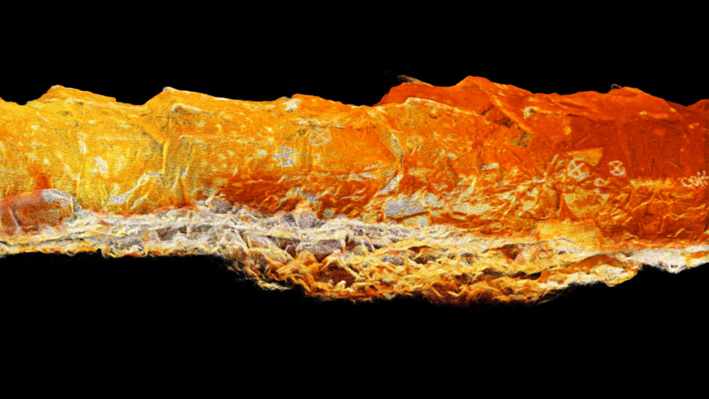
Scan captured:
-
tunnel profile from the surge shaft to debris flow clearly showing the blasting profile from the original 1940’s development
-
along the debris flow showing block sizes and allowed an estimate of volume of failure
-
into the failure where the use of LiDAR intensity clearly identified a dyke within the fault zone and fault offsets through the dyke
-
the failure surface and rill of failed material
-
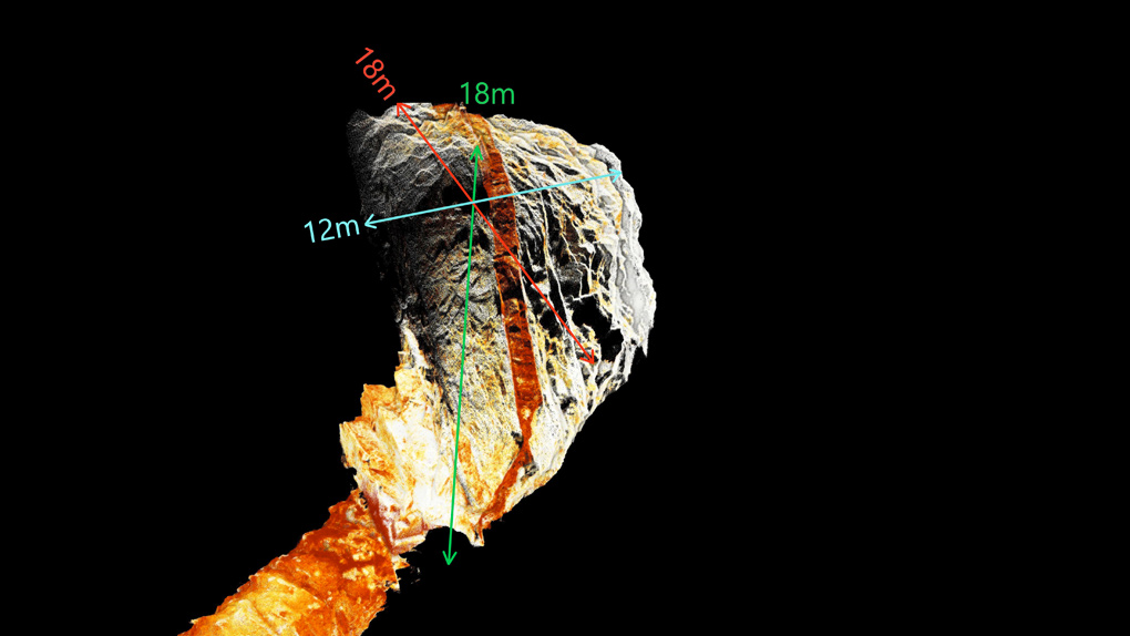
failure dimensions measured and failure volume calculated to feed back to bypass tunnel design engineers
Size of the failure was measured as approximately 18m high by 17m wide by 12m across.
CTA/Conclusion:
Scan could have not been performed utilising other techniques without removal of significant volume of debris flow material. This enabled by-pass design to be completed with confidence by understanding the shape and volume of the void.
Videos & Images