by MineLiDAR | Aug 31, 2021
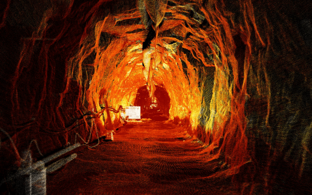
Scanning a 1940s Headrace Tunnel The client had a major collapse at a fault crossing a 1940’s headrace tunnel. This tunnel supplied water to a hydroelectric power station and the collapse restricted the flow of water and power generation capacity. MineLiDAR completed...
by MineLiDAR | Aug 31, 2021
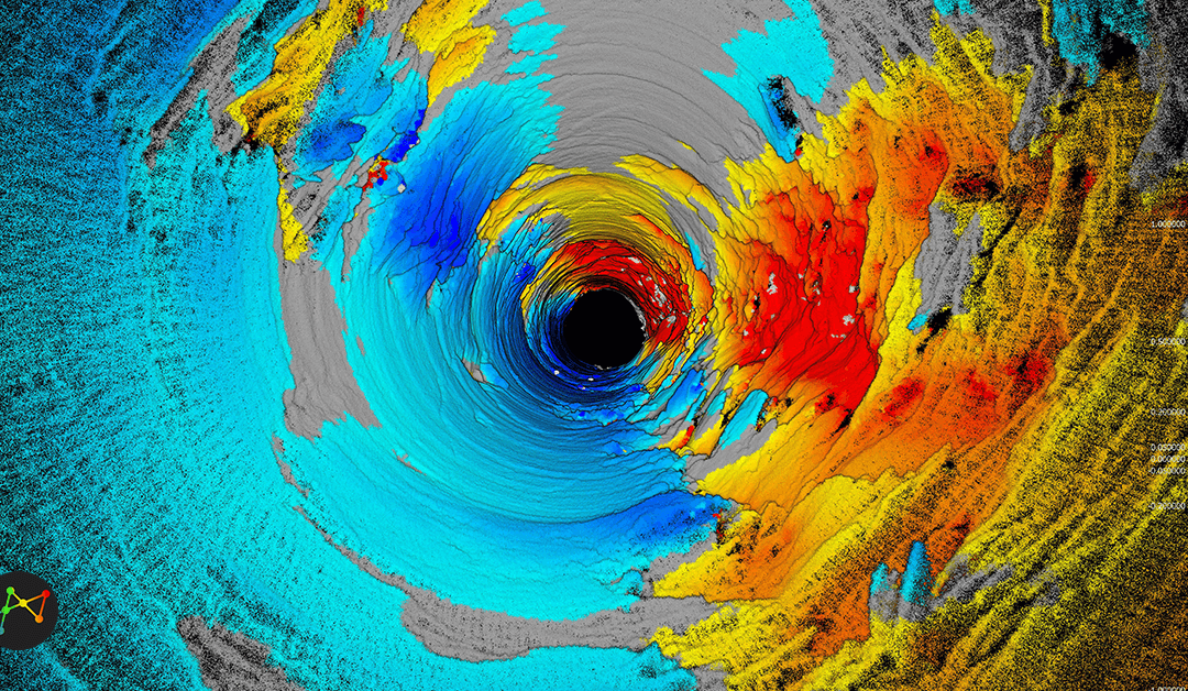
Conducting a Raisebore Examination The client had engaged MineGeoTech to undertake the geotechnical design assessment for a 4.5m diameter ventilation raisebore between 1045m and 1208m below surface to assist development of a new area the mine. As a means of validating...
by MineLiDAR | May 6, 2021
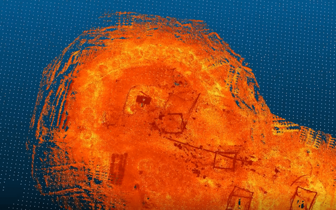
Diving into Old Mine Voids One of our recent projects involved scanning some very old mine voids to assist Red 5 Limited with their open pit design. The scans provide an understanding of the depth of the voids, and the direction of lateral development off them as...
by geographik | Jul 20, 2020
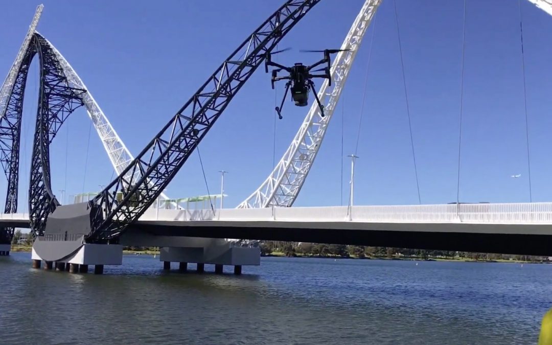
Scanning the Matagarup Bridge The MINELiDAR crewing scanning the Matagarup Bridge in East Perth over the Swan River using the Emesent Hovermap drone. << Return to...