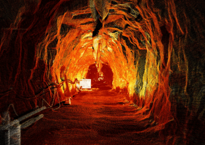
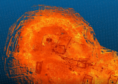
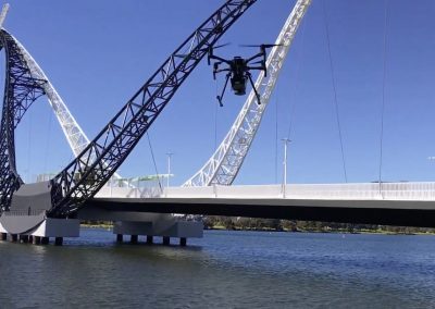
MINELiDAR
  • Our Services
    • Underground Mining
      • Shafts, Raisebores, and Ore Passes
      • Routine Scanning
      • Pillar Dimensions
      • Rockfall and Seismic Damage Assessment
      • Old Workings Re-entry
      • Stope Reconciliation
      • Change Detection
    • Above Ground
      • Erosion Mapping
      • Rehabilitation Monitoring
      • Pit Wall Stability Monitoring and Slope Failure
      • Old Workings
      • Photogrammetry and Multispectral Imaging
      • Vegetation Mapping
      • Point Cloud Colourisation
    • Infrastructure
    • Data Processing and Analysis
      • Structural Mapping
      • Displacement Monitoring
      • Stope Reconciliation
      • Digital Terrain Modelling / Vegetation Removal
    • Bathymetric Surveys
  • Applications
    • Drone Mounted
    • Handheld LiDAR
    • Winched
    • Vehicle Mounted
  • Case Studies
    • Collapsed Tunnel
    • Raisebore Examination
    • Improving Convergence Monitoring
  • Media
    • Articles
    • Videos
  • Contact Us
Select Page

Videos

See us in action:

Scanning a 1940s Headrace Tunnel

Scanning a 1940s Headrace Tunnel

Conducting a Raisebore Examination

Conducting a Raisebore Examination

Diving into Old Mine Voids

Diving into Old Mine Voids

Scanning the Matagarup Bridge

Scanning the Matagarup Bridge

Check out our YouTube 

Watch now

MINELiDAR offers drone mounted, handheld, winched and vehicle driven LiDAR scanning services across a wide range of industries.


Privacy Policy


Contact Us

ua.mo1746766120c.rad1746766120ileni1746766120m@tca1746766120tnoc1746766120

+61 8 9382 8386

Unit 4/2 Edward Street
Perth WA 6000

View Map

Connect with us

MineLiDAR - LinkedIn MineLiDAR - YouTube MineLiDAR - Instagram MineLiDAR - Facebook

 Copyright MineLiDAR Pty Ltd 2024