MINELiDAR
  • Our Services
    • Underground Mining
      • Shafts, Raisebores, and Ore Passes
      • Routine Scanning
      • Pillar Dimensions
      • Rockfall and Seismic Damage Assessment
      • Old Workings Re-entry
      • Stope Reconciliation
      • Change Detection
    • Above Ground
      • Erosion Mapping
      • Rehabilitation Monitoring
      • Pit Wall Stability Monitoring and Slope Failure
      • Old Workings
      • Photogrammetry and Multispectral Imaging
      • Vegetation Mapping
      • Point Cloud Colourisation
    • Infrastructure
    • Data Processing and Analysis
      • Structural Mapping
      • Displacement Monitoring
      • Stope Reconciliation
      • Digital Terrain Modelling / Vegetation Removal
    • Bathymetric Surveys
  • Applications
    • Drone Mounted
    • Handheld LiDAR
    • Winched
    • Vehicle Mounted
  • Case Studies
    • Collapsed Tunnel
    • Raisebore Examination
    • Case Study: Improving Convergence Monitoring
  • Media
    • Articles
    • Videos
  • Contact Us
Select Page
POV: You’re the LiDAR Scanning Unit in a Raisebore Examination

POV: You’re the LiDAR Scanning Unit in a Raisebore Examination

by MineLiDAR | Sep 21, 2022 | Article

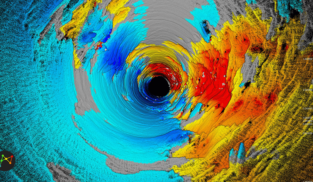
The client had engaged our sister company MineGeoTech to undertake the geotechnical design assessment for a 4.5m diameter ventilation raisebore between 1045m and 1208m below surface to assist development of a new area the mine. As a means of validating the assessment...

MINELiDAR offers drone mounted, handheld, winched and vehicle driven LiDAR scanning services across a wide range of industries.


Privacy Policy


Contact Us

ua.mo1765578822c.rad1765578822ileni1765578822m@tca1765578822tnoc1765578822

+61 8 9382 8386

Unit 4/2 Edward Street
Perth WA 6000

View Map

Connect with us

MineLiDAR - LinkedIn MineLiDAR - YouTube MineLiDAR - Instagram MineLiDAR - Facebook

 Copyright MineLiDAR Pty Ltd 2024