
by MineLiDAR | Feb 3, 2026 | Article
It’s been a while since we sat down with Peter to chat about how he found himself on sites flying drones and assessing old mine shafts! Remind us – what is your role, and how long have you been keeping busy with MineLiDAR (MLD) projects? It always...
by MineLiDAR | Oct 14, 2024 | Article
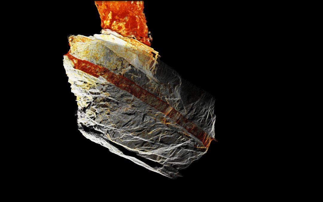
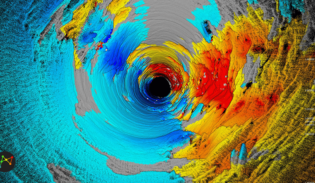
This week MineLiDAR is supporting one of our clients to define ore and waste as well as ore direction using LiDAR intensity. Let’s see what we have uncovered. Image 1: Stope Vein Image 2: Close Up of Stope Vein Veins and other intrusive units can show up quite...
by MineLiDAR | Dec 6, 2023 | Article
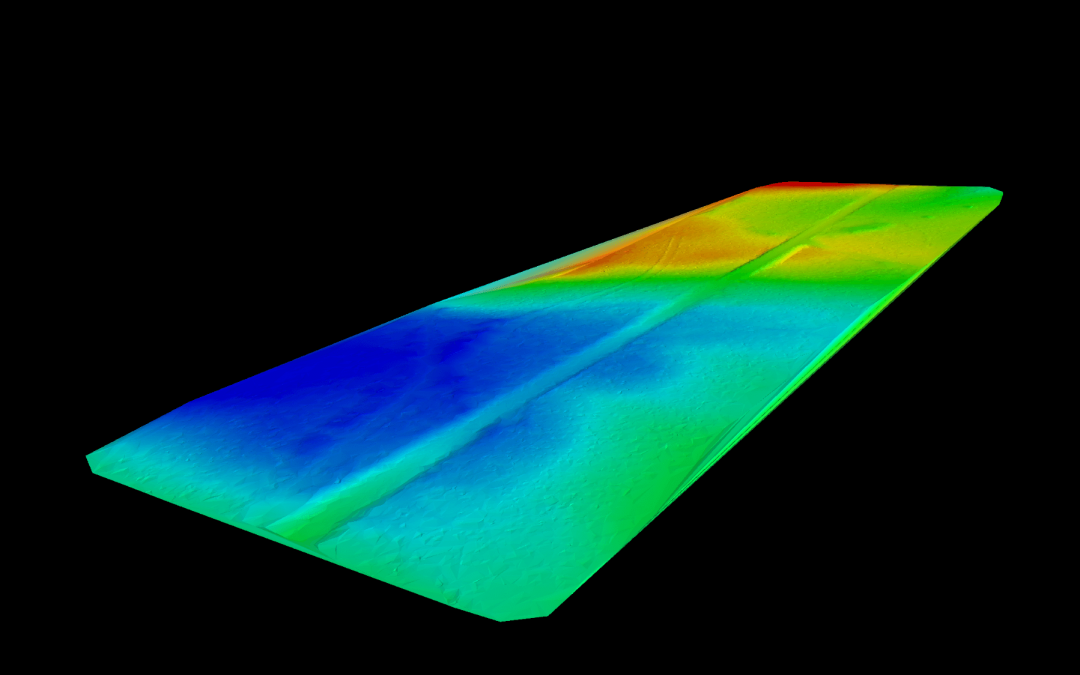
DTM stands for Digital Terrain Model and is a digital description of a given geographical region. Digital Terrain Models (DTMs) are typically generated using ground-based laser scanning to provide high-resolution bare earth models of the terrain surface. The data...
by MineLiDAR | Oct 5, 2022 | Article
Rio Tinto engaged us to demonstrate an improved method for convergence monitoring – and we did just that. Comprehensive and accurate convergence data at Rio Tinto’s Argyle Diamond Mine delivered by MineLiDAR using Emesent’s Hovermap provides a basis for improved...
by MineLiDAR | Sep 29, 2022 | Article
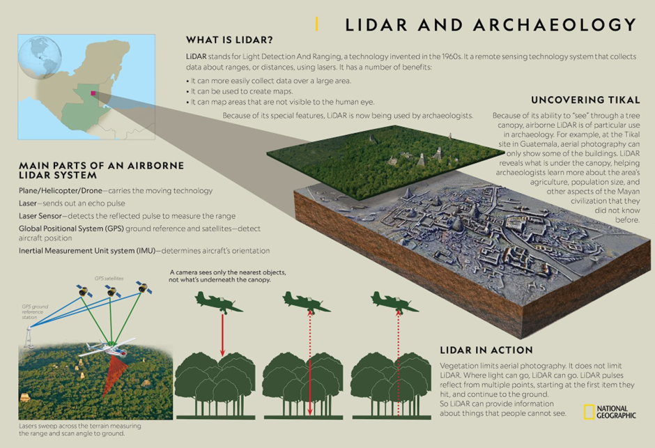
Image Courtesy: National Geographic Whilst most of our work is in mining, we came across this interesting infographic and thought to share it to illustrate how LiDAR can be applied in different industries, such as archaeology. LiDAR is a technology that has been...
by MineLiDAR | Sep 21, 2022 | Article
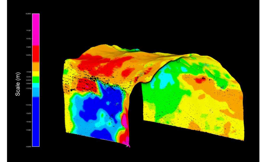
The client had engaged our sister company MineGeoTech to undertake the geotechnical design assessment for a 4.5m diameter ventilation raisebore between 1045m and 1208m below surface to assist development of a new area the mine. As a means of validating the assessment...